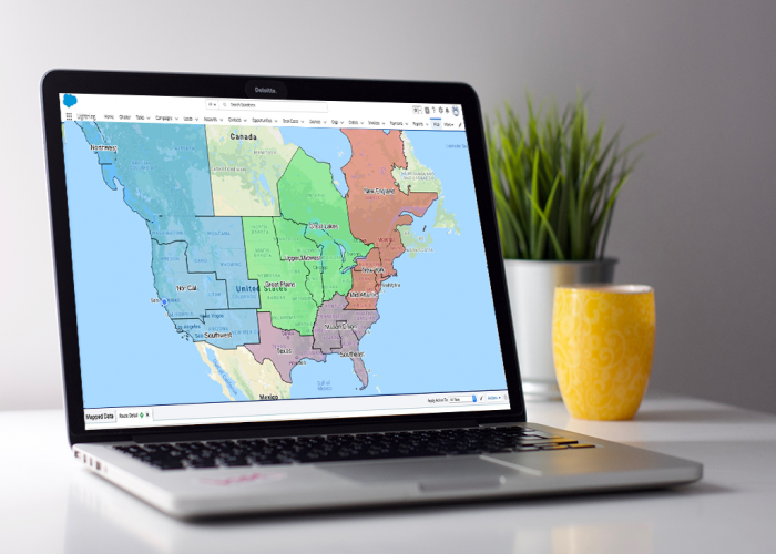
 Few business processes are more geographically important than the design and management of your sales territories. Managing your team’s sales territories is very necessary but doing so with spreadsheets and arbitrary boundaries may be a painstaking experience.
Territory management allows organizations to operate their business more efficiently. By dividing and conquering large sections of the country or world for specific sales people or teams to focus on, organizations can ensure that all prospects are being given the correct amount of attention and focus during the sales cycle. If you take shortcuts and overload some territories while leaving others thin, you are not going to maximize your sales output. Some reps will be frustrated and underperform, other reps will cherry pick and ignore some prospects.
Territory mapping software helps organizations use a map to geographically visualize, define and even map out territories, simplifying your job, guaranteed. Without a mapping software, it can be difficult to balance and optimize territories. For many, the norm includes CRM exports, pivot tables, manual updates and loading data back into CRM, which can be a painful and error-prone process. That’s why sales territory mapping software is crucial to an organization’s business processes. The question is, how does an organization successfully implement and maintain territories?
Start with CRM Data to Create Intelligent Sales Territories with Geopointe
The advantage to creating territory boundaries using Geopointe is that any data in Salesforce can be accessed to create your territories including activity, pipeline, contact and account demographics, and more. The goal is for each of the new territories to have a similar number of accounts, ARR, licensed assigned, or whatever other metrics you use to plan your territories.
Create Shapes to Map Territories – Right in Salesforce
In fact, if you’re creating sales territory boundaries it’s the perfect time to start utilizing Geopointe’s shape library. You can split larger states, like California, by using the map to help define the new boundaries. Search Accounts in a clustered view to get a better sense of where the heavy concentrations are.
Using Geopointe’s visual shape library, you can easily design territories via your pre-created custom shapes that can be utilized directly from the map using ZIP codes, counties, populations, etc. This allows you to easily view the number of prospects or customers in the shape then draw boundaries equally based on heavily populated areas.
Easy Updates and Sales Handoff
No matter what organization you work for, people will undoubtedly leave for other opportunities. With Geopointe’s territory mapping software, easily mass reassign records when territory changes occur.
Sales territories are effective because they divide an area into smaller regions, making it easier to focus on revenue-generating opportunities. They also encourage salespeople to take ownership of their area, driving accountability and the freedom to take initiative where necessary.
Looking to incorporate territory mapping software to optimize your team’s productivity in the field? Request a demo to learn more!


