“A map is the greatest of all epic poems. Its lines and colors show the realization of great dreams.”
– Gilbert H. Grosvenor, Editor of National Geographic (1903 – 1954)
Accurately identifying our exact location on earth has been a fascination of mankind since the Ancient Greeks used the stars to triangulate their position. Today, we have a wide-array of location-based services that have made their way into office buildings and jean pockets everywhere. From professional services like Geopointe to consumer-facing services like Waze, the evolution of geolocation technology has come light-years from the days of Plato and Aristotle.
With all of the progress made and all of the efficiencies introduced, geolocation’s history is uniquely fascinating. Let’s take a look at how far we’ve come:
2,000+ Years Ago – Ancient Greeks triangulated their geographical location using only the stars.
1933 – Radar is finally on the map, as the U.S Naval Research Laboratory’s Leo Young, proposed the use of a pulse radar technique to be able to detect aircraft and ships.
1940 – The Naval Research Laboratory enabled the first submarine to use radar. It had a 20-mile range.[1]
1957 – Sputnik I, the first artificial satellite to go into space, is launched by the Soviet Union. It was about the size of a beach ball at 58 cm., weighed only 184 pounds, and took about 98 minutes to orbit the Earth on its elliptical path.[2]
1973 – The Navstar Global Positioning Satellite (GPS) system is proposed by the Pentagon.[3]
1978 – The first 11 Navstar GPS satellites are launched into space.[4]
1983 – President Ronald Reagan offers to let all civilian commercial aircraft use the GPS system to improve air navigation safety. Although, the commercial use of GPS is granted with “selective availability,” or restricted use.[5]
1989 – Magellan becomes the first to sell a hand-held navigation device with the release of the Magellan NAV 1000.
1993 – The U.S. Air Force sends the final Navstar GPS satellite into orbit, completing an entire network of 24 Global Positioning System (GPS) satellites. Although, they were not yet fully operational.
1995 – The Navstar GPS program reached a fully operational status in April of 1995. The project cost 10 to 12 billion dollars.[6]
1999 – The first commercial use of GPS – a safety phone called the Benefon Esc! – is released for consumer purchase. It is sold mainly in Europe.[7]
2000 – President Bill Clinton lifts “selective availability” on GPS-usage for civilians. This allows civilians and consumer-facing services to use GPS with the same pinpoint accuracy as the military.[8]
2002 – Nikon introduces their D1H & D1X camera models – the first DSLR cameras to offer a GPS interface.
2004 – Up to 15 percent of U.S. farmers use GPS-controlled tractors and/or combines and are saving as much as 5 percent in fertilizers and pesticides with the use of precision guidance systems.[9]
2005 – GIOVE-A, Europe’s first experimental GPS satellite is launched into space, serving to test critical technologies for the Galileo program, meant to give Europe independence from the U.S, Russian and Chinese GPS systems. The program is scheduled to be fully operational in 2020.[10]
2005 – Google Maps officially debuts!
2005 – Yelp popularizes location-based reviews leveraging geolocation technologies.
2006 – After testing equipment, such as the handheld SkyCaddie, and being courted by the electronic industry for several years, the U.S. Golf Association permits distance-measuring GPS devices and laser range finders.[11]
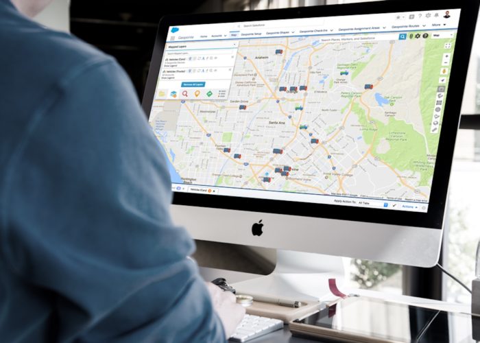
2006 – Geopointe is founded, revolutionizing the way Salesforce users can visually leverage their data.

2007 – GPS becomes a multi-billion-dollar industry, causing further restrictions to be lifted on commercial usage by President George W. Bush.
2009 – Foursquare launches, helping further popularize geolocation review and reward services.
2012 – The U.S Supreme Court rules that warrantless GPS tracking is constitutional.
2015 – Facebook begins licensing location-based data from Factual, a geodata platform. This includes “US Places data,” which includes hotels and restaurants “extended attributes,” to support Facebook business pages, check-ins, Places search and more.[12]
2017 – Match.com reportedly enables users to see which other users they have crossed real-life paths with.
2017 – Facebook fights to represent the primary “digital presence” for local businesses. With 2.5 billion comments being added to Facebook business Pages every month, they are now competing directly with Google.[13]
Interested in leveraging geolocation technology for your organization’s needs? Click the link below to download a free trial of Geopointe or watch a live demo of our product!


