If you haven’t already heard, Geopointe’s June 2017 Release is now available for download on the Salesforce AppExchange, and while our May 2017 Release focused on adding several fancy new features, this latest update was more practical. With an eye on the user-experience (UX), we focused on listening to feedback from our customers and providing enhancements to address their most common needs.
So, we read your reviews, and took notes from our interactions with the Geopointe community, then planned this summer’s update based on your feedback. Here’s what we heard and the enhancements we made in response:
Community: “How can I see more about locations, without leaving my map?”
Geopointe: Now you can quickly see three key pieces of information from location markers and configure the display (color and icons) of markers with multiple fields. Once you download Geopointe’s latest release, you can use these custom visual enhancements to optimize your team’s comprehension of key data points by creating easily identifiable markers that signify those key points.
“This is really useful for providing information at a glance,” Jason Venable, VP of Technology said (Geopointe June 2017 Release Webinar).
“With the map, there’s a lot of information that’s scattered all over the place. So, the easier you can make it for a user to look at a marker on the map and identify information, the better the user experience and the more efficient that person will be,” Jason clarified.
Community: “Are Salesforce reports usable as data sets for my maps? If not, can you add this functionality?”
Geopointe: You can now source data sets from Salesforce reports! When you make an adjustment to a Salesforce report, that same change will be immediately reflected on the map as well. While still in BETA, it currently supports the most commonly used report types, including Account Reports, Contact Reports, Lead Reports and Opportunity Reports.
“A request we often see – especially with new customers – is they have a list of established Salesforce reports that they’re using, and we can now use those Salesforce reports as a source for a dataset search on the map,” said Jason. “It really helps people get up and running that have established processes and reports in place.”
He went on to clarify, “The core thing here is that data sets can now be sourced or driven from a report. And, the important thing to also understand here is that the report is a source of truth. We’re not creating a data set, at least not yet.”
Jason noted, “It is something admins need to turn on, it’s something admins are going to want to test and make sure it meets their needs before rolling it out to all of their users.”
Community: “Is there any way to perform a more accurate ‘Nearby Search’ during peak traffic hours?”
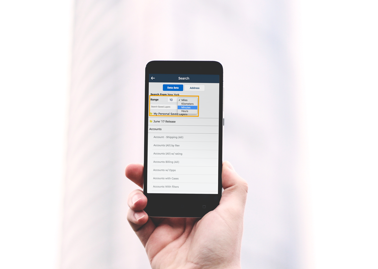 Geopointe: Our latest release substantially improves the “Nearby Search” functionality. Now when you’re looking to perform a nearby search, you can search based on time – since distance isn’t always the best way to get accurate results. The update will be available in your web browser and your Salesforce1 mobile app.
“In the past, we would only be able to search by a fixed radius within 5 miles or so. That has great applications, but there are also times where you want to know how long it’s going to take to get somewhere. So, we allow you to search nearby with that metric as well,” Jason shared.
“If you’re searching for 5 miles around you in [Los Angeles] rush hour traffic, there’s no way you could get to some of those points within 30 minutes,” he said.
One obvious beneficiary of this update? Jason believes that sales reps in the field who have set appointments will now be able to optimize that time, without worrying about making it to their next meeting on time.
Community: “When will I be able to use shape fields from a mobile device?”
Geopointe: For those of you who use the “Shape Fields” feature on your desktop, we’ve officially added it to your mobile Salesforce1 experience. We’ve also added a large batch of additional shapes for you to use!
Speaking about the desktop experience, Jason said, “It’s a really awesome feature we’ve had in Geopointe for, probably about two years now. And, what it allows you to do is – if you’re familiar with setting up a Salesforce custom object or a Salesforce custom fields – you get a big list of fields that you have to choose from.”
Now, those abilities have gone mobile, allowing a seamless experience between field and office teams.
“It’s also really great for service and delivery areas. So maybe you have accounts that only deliver within a certain ZIP code, or within only so many miles from the center point of that particular record. Those are some great use cases for [mobile] shape fields,” Jason said.
Community: “As an admin, how can I update the user settings for all of our Geopointe users?”
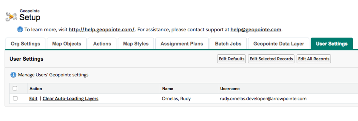
Geopointe: Previously, you had to update user settings individually. Now, with the launch of this update, you can make large-scale setting customizations – companywide or group-based – for a more synergistic Geopointe user-experience, and fewer headaches for admins.
Discussing the reason for the change, Jason clarified, “Geopointe is a very robust, mature application, with lots of features, and as we’ve grown, we’ve grown out the list of settings and configuration variables that users can control. This allows users to change any from whether the sidebar is hidden, what the map looks like, whether the scroll wheel should zoom in and out of the map – all that stuff is user configurable.”
“As an admin in training perspective, sometimes it’s nice to keep these consistent, or update existing users to a pre-established set of settings, just to keep documentation consistent, and the experience across all the users as well,” he said.
“Admins can either update all users or update a small subset of users at once. If there are just a few users you need to help out and adjust their settings for them, you can do that,” he pointed out.
While it’s not jam-packed with as many shiny features as our previous update, we believe in refining our product’s core features to provide you with a well-oiled engine before we add rims to the tires.To learn more about our latest release, click the link below to watch the webinar, or simply download the June 2017 Release here.

